Skirting the Edge: A Walk Through Chinatown’s Borders

How do you define the borders of a Chinatown?
A few days ago, while planning my walk through Manhattan’s Chinatown I wondered where it started or ended. I wanted to skirt the edges of Chinatown or at least see where the neighborhood lines start to blur. It’s a question I’ve been turning over: where is Chinatown, really?
Google Maps has an answer. It always does. Here’s what it shows (my crude painted border overlays Google Map’s thin red line):
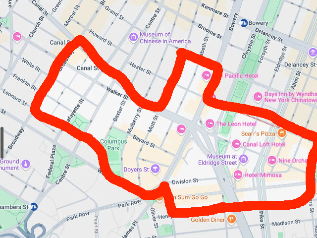
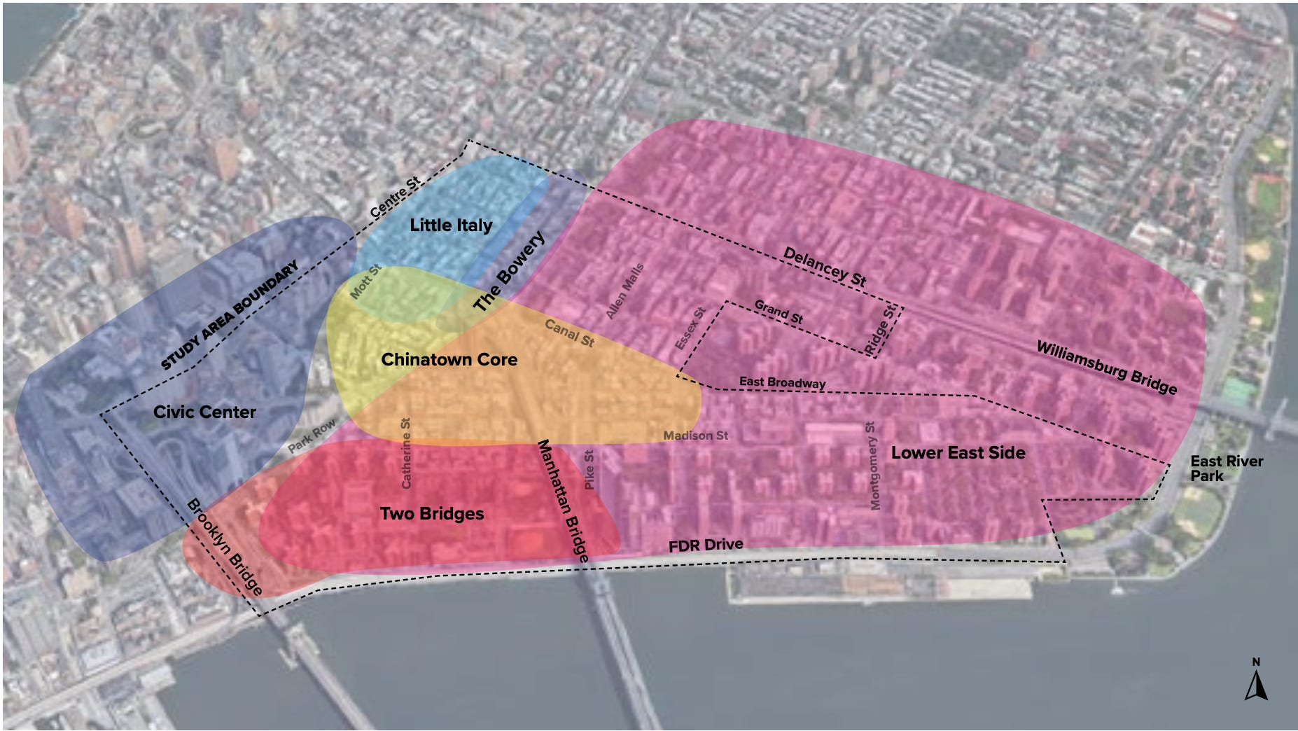
Google isn’t the only entity trying to define Chinatown — here’s how the ‘study area’ proposed by the Chinatown Downtown Revitalization Strategic Investment Plan draws the borders. This plan lays out how $20M will be invested in the area over the coming years and defines the scope of that investment. Interesting that Little Italy is included in the study area and the area to the east of Essex is not. Maybe the Italians want a piece of the investment.
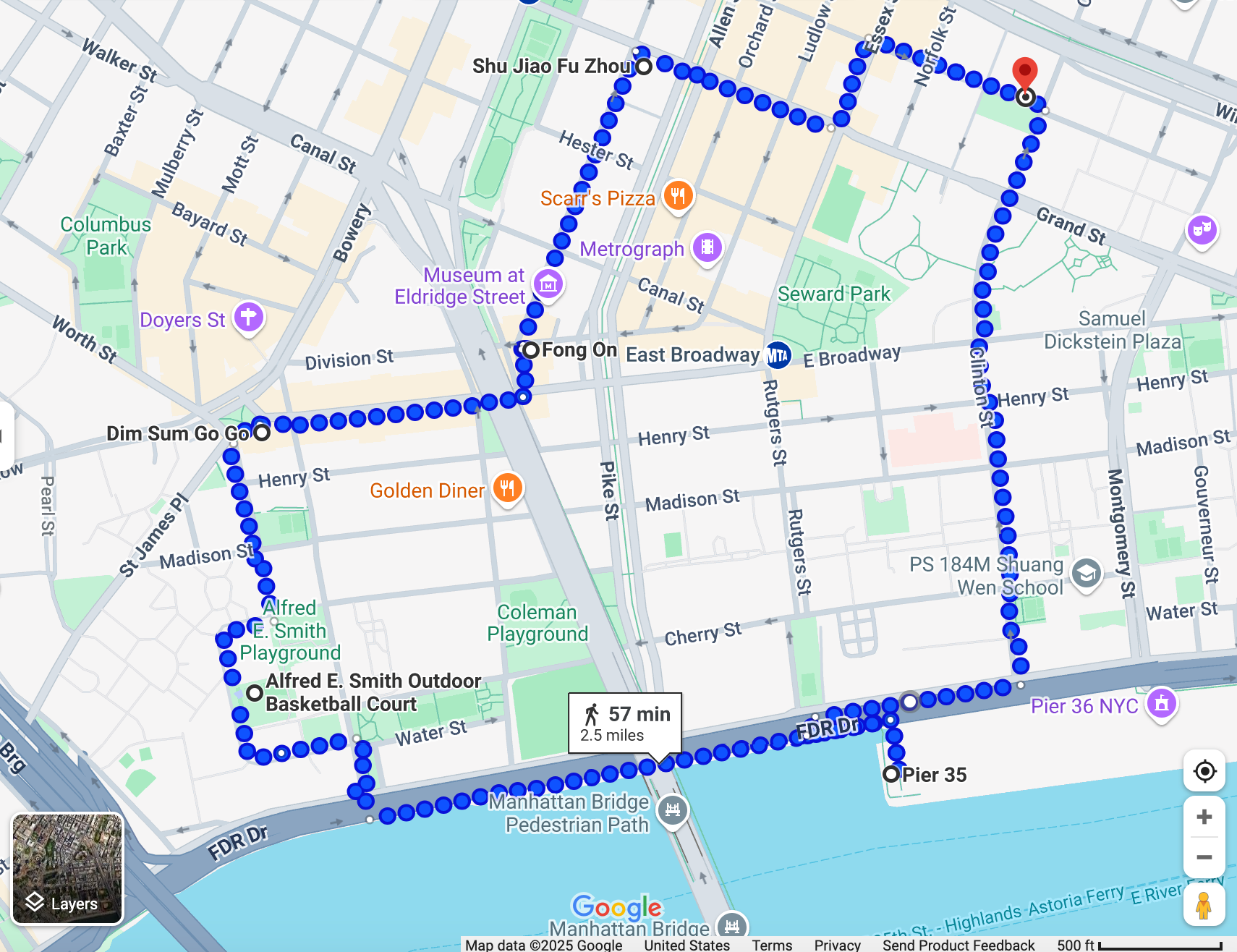
Here’s the route I planned to take, wandering slightly outside Google’s borders and within the “study area”, trying to understand how this neighborhood expands, contracts, and folds into others.
To be clear, I’m not trying to define the borders of Chinatown. I’m not the guy to do that.
I’m just curious about the multitude of ways Chinatown borders are drawn—and who gets to draw them.
Does Google just send someone out with a Street View camera and let them decide? Or is there an AI model out there making the call—based on a certain density of noodle shops, red signage, and Chinese grandmas with grocery carts that appear in the Street View photos?
Anyways, enough postulating about imaginary borders, let’s get onto the photos.
Field Notes: Civic engagement
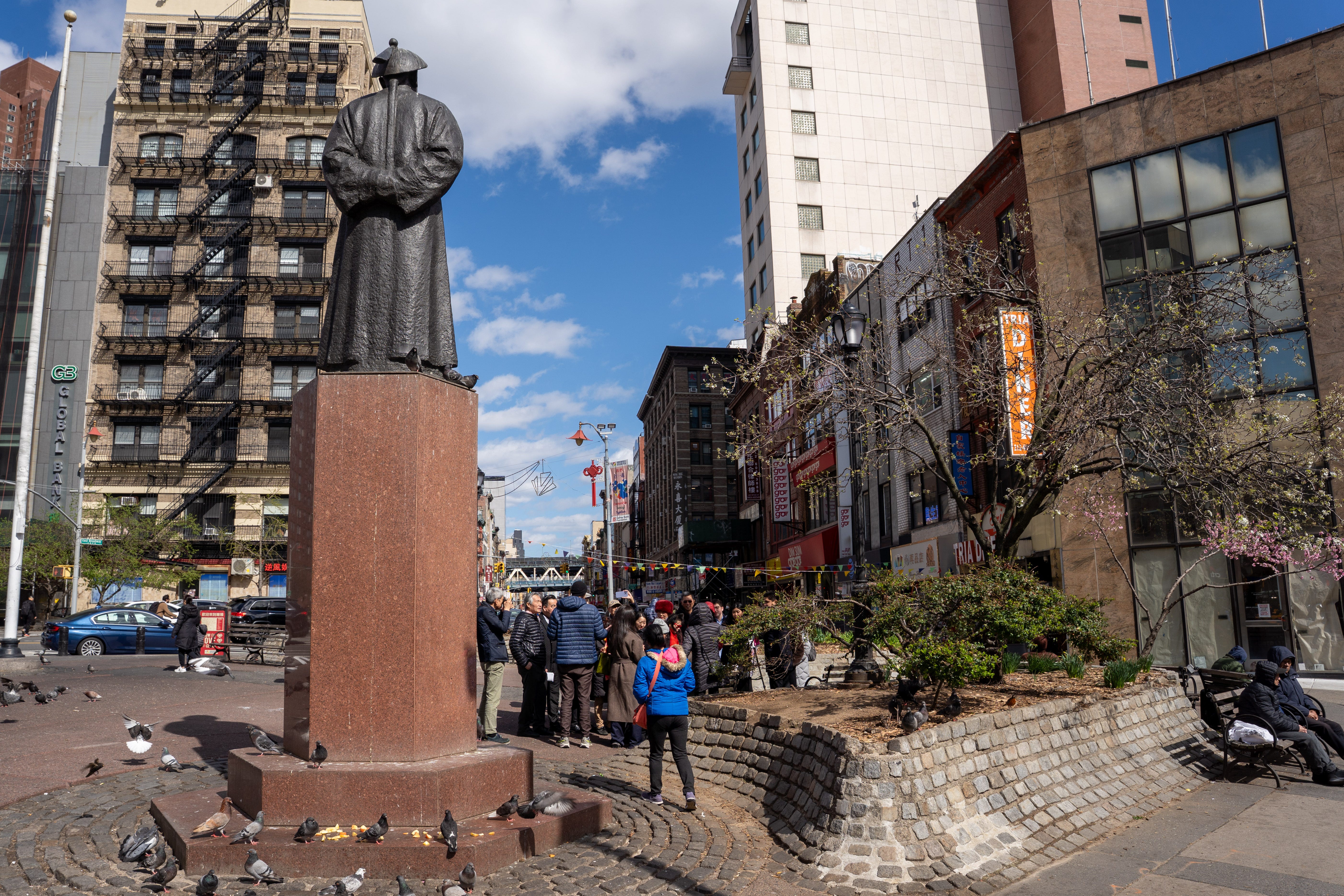
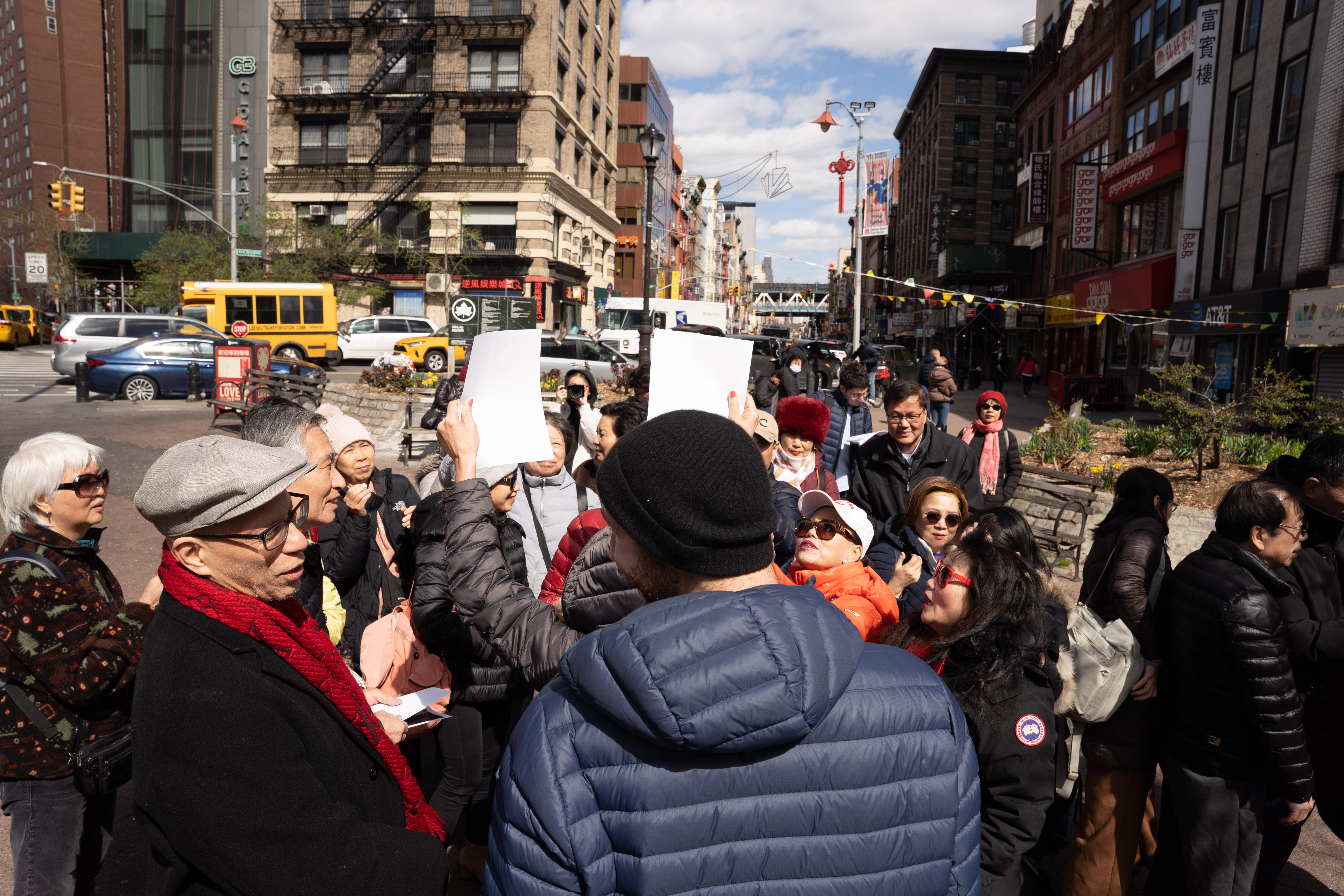
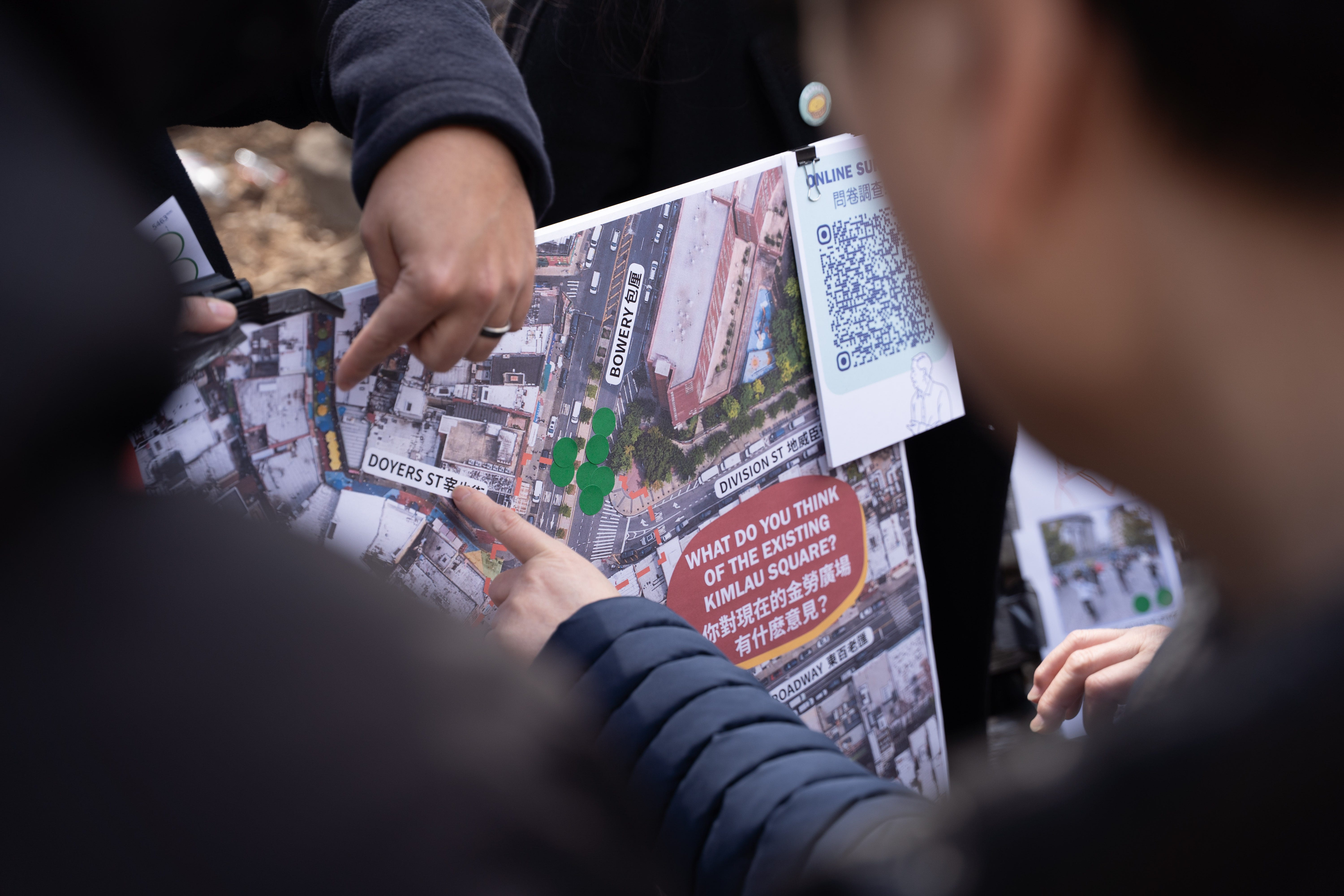
As I walked through Kimlau Square, I stumbled across a pop-up hosted by the Chinatown Downtown Revitalization team. They were gathering feedback from locals on how the area should evolve—rapid-fire Mandarin and Cantonese punctuated the event. A mix of consultants, community members, and business reps were running the show.
Sticky notes covered blown-up maps, flyers advertised renderings of potential “Friendship Gates,” and lots of group photos were taken. It’s not civic engagement without proof you were there, apparently.
This was the first time I’d photographed community engagement in a Chinatown, and I’m glad that these images can add another layer of nuance to Diaspora. For more information on the project, check out https://chinatownconnections.nyc.
Field Notes: More storefronts
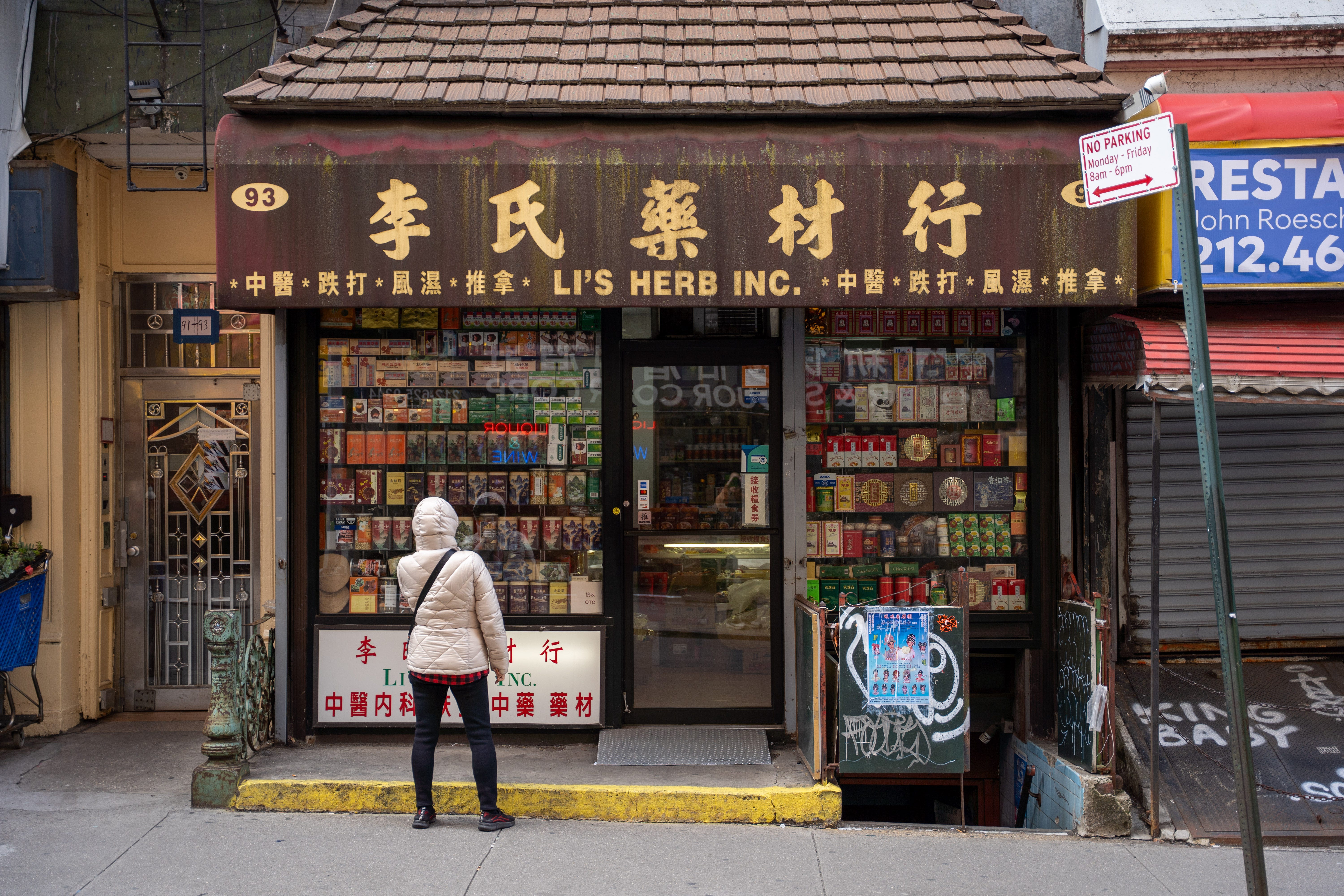
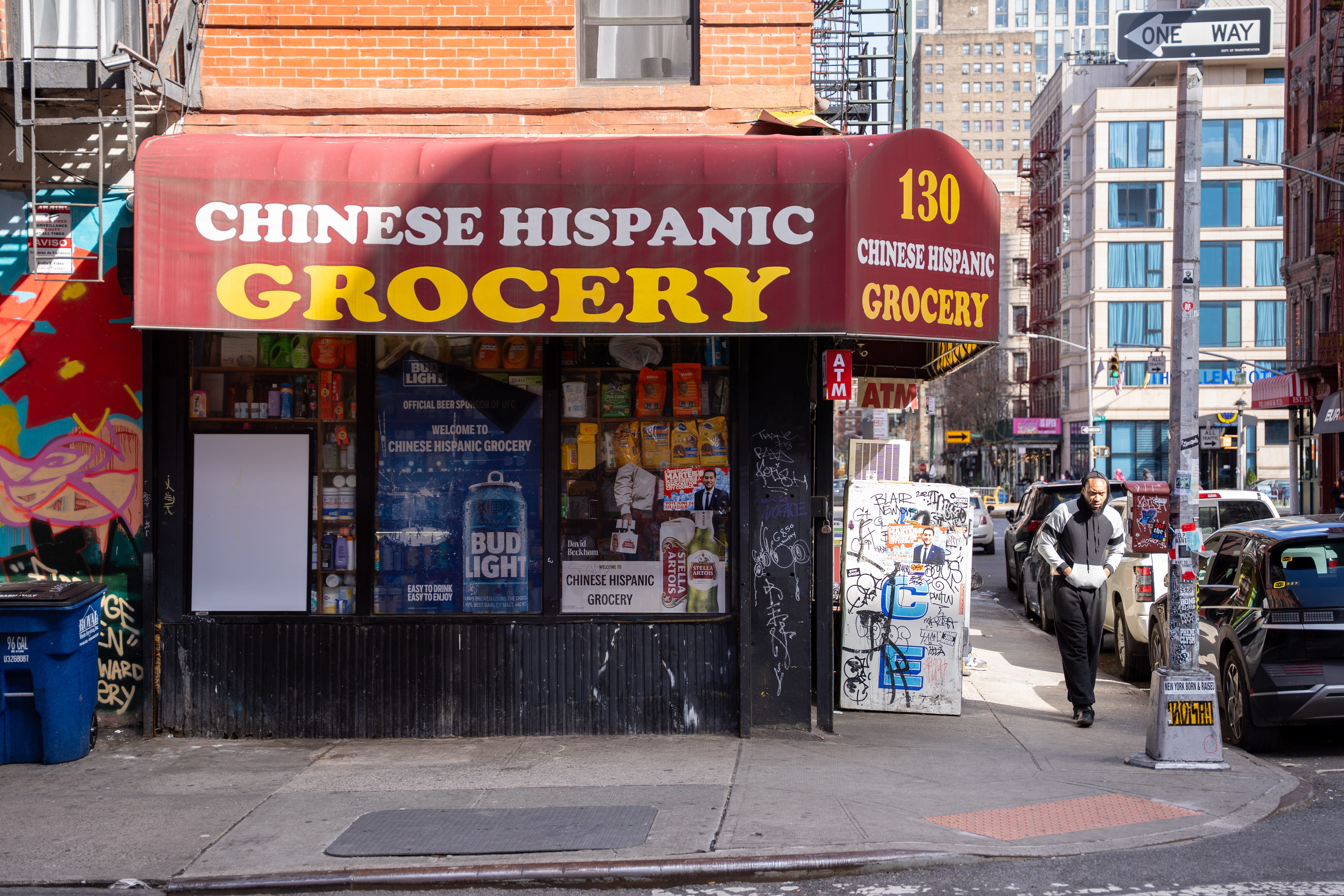
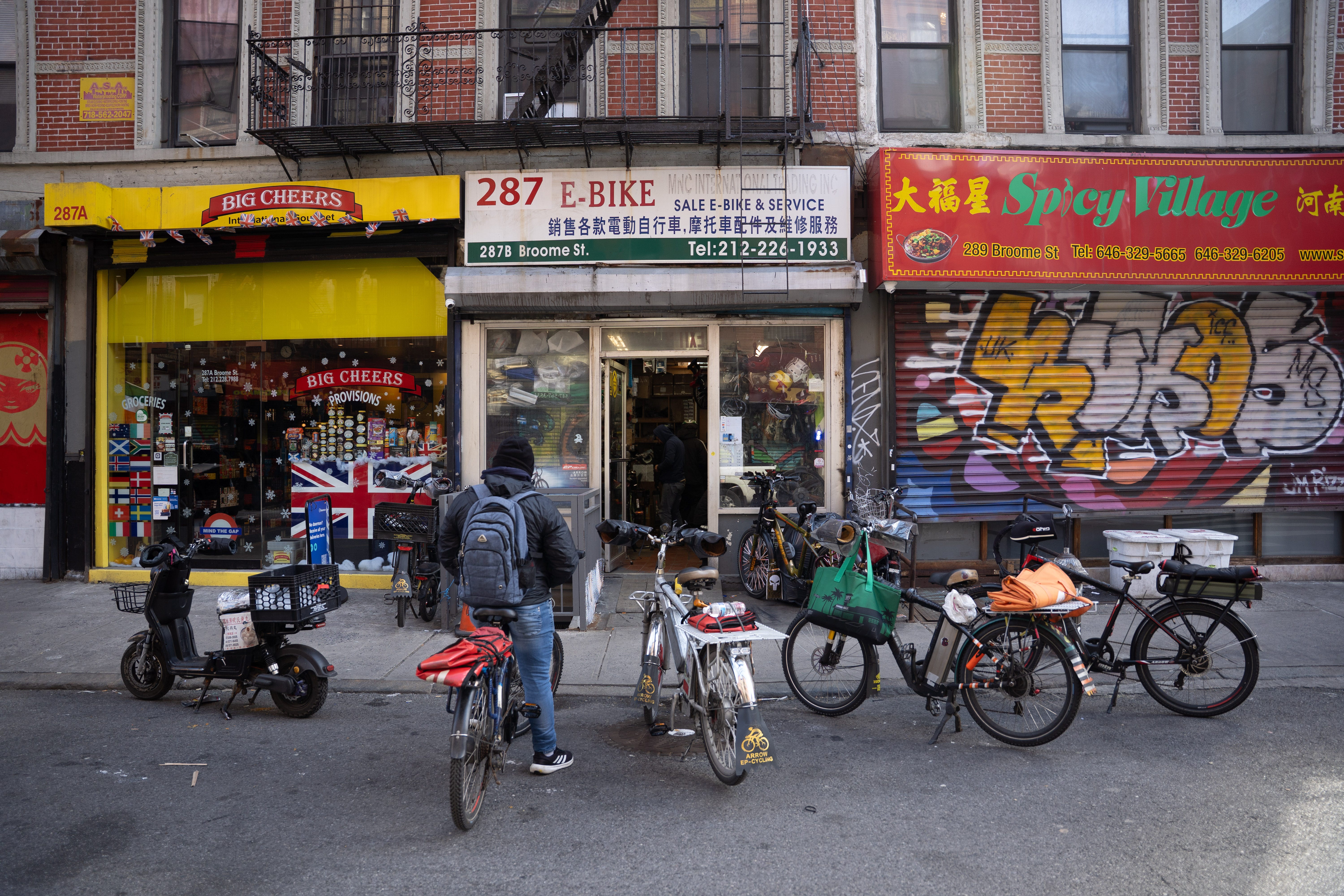
One of my goals on this walk was to photograph storefronts in their full texture—signage, clutter, shadow, movement. These scenes say so much about the character of the neighborhood. I kept looking for moments when a passerby would complete the composition, like punctuation at the end of a sentence.
In each photo I’ve shared here, a pedestrian supports the narrative. In the first, a Chinese woman contemplates the wares on display. In the second, a Black man walks past a Chinese-Hispanic grocery store, a reminder of the neighborhood’s diversity. In the last, a delivery driver waits outside a bustling e-bike repair shop.
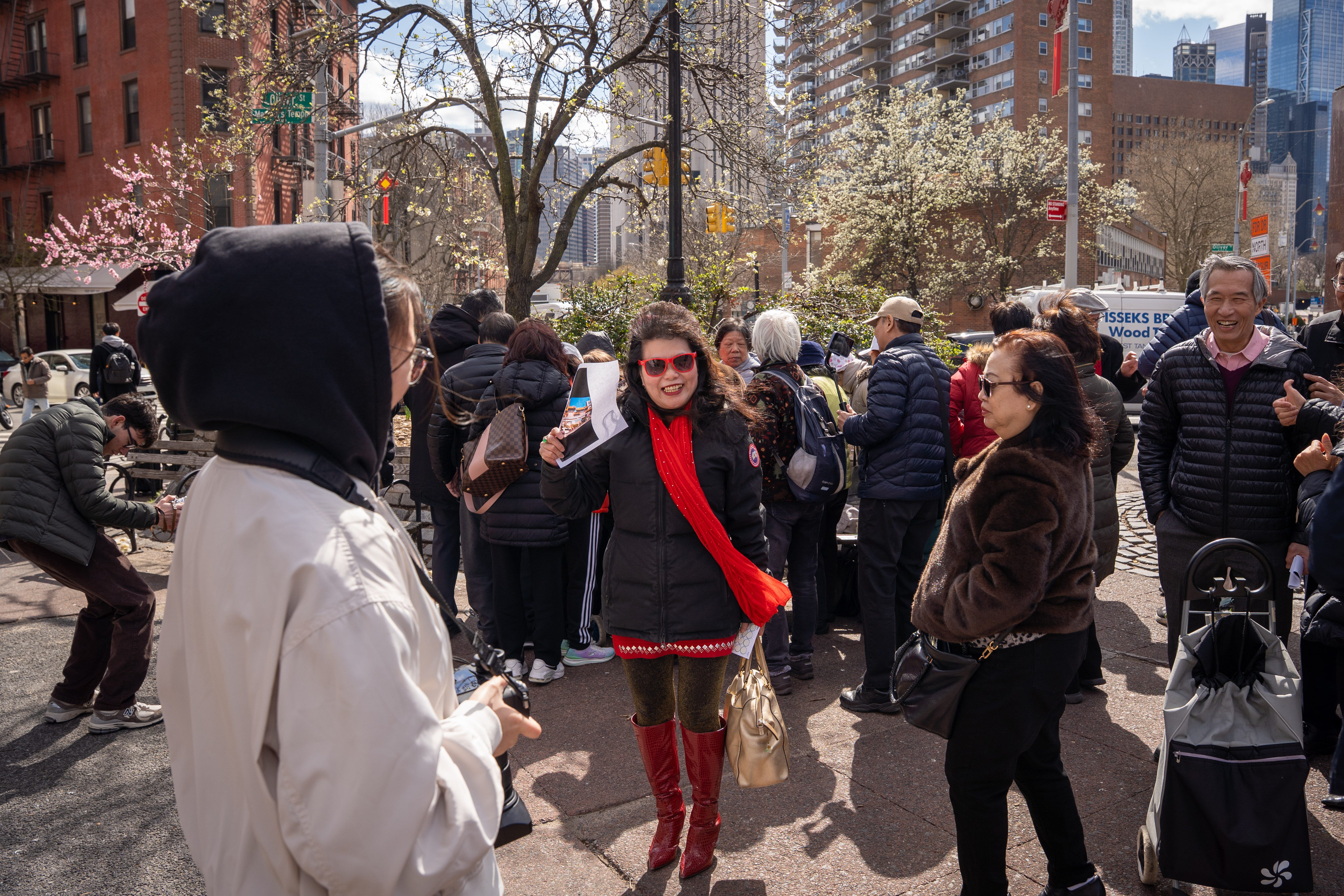
Field Notes: Smaller Scenes
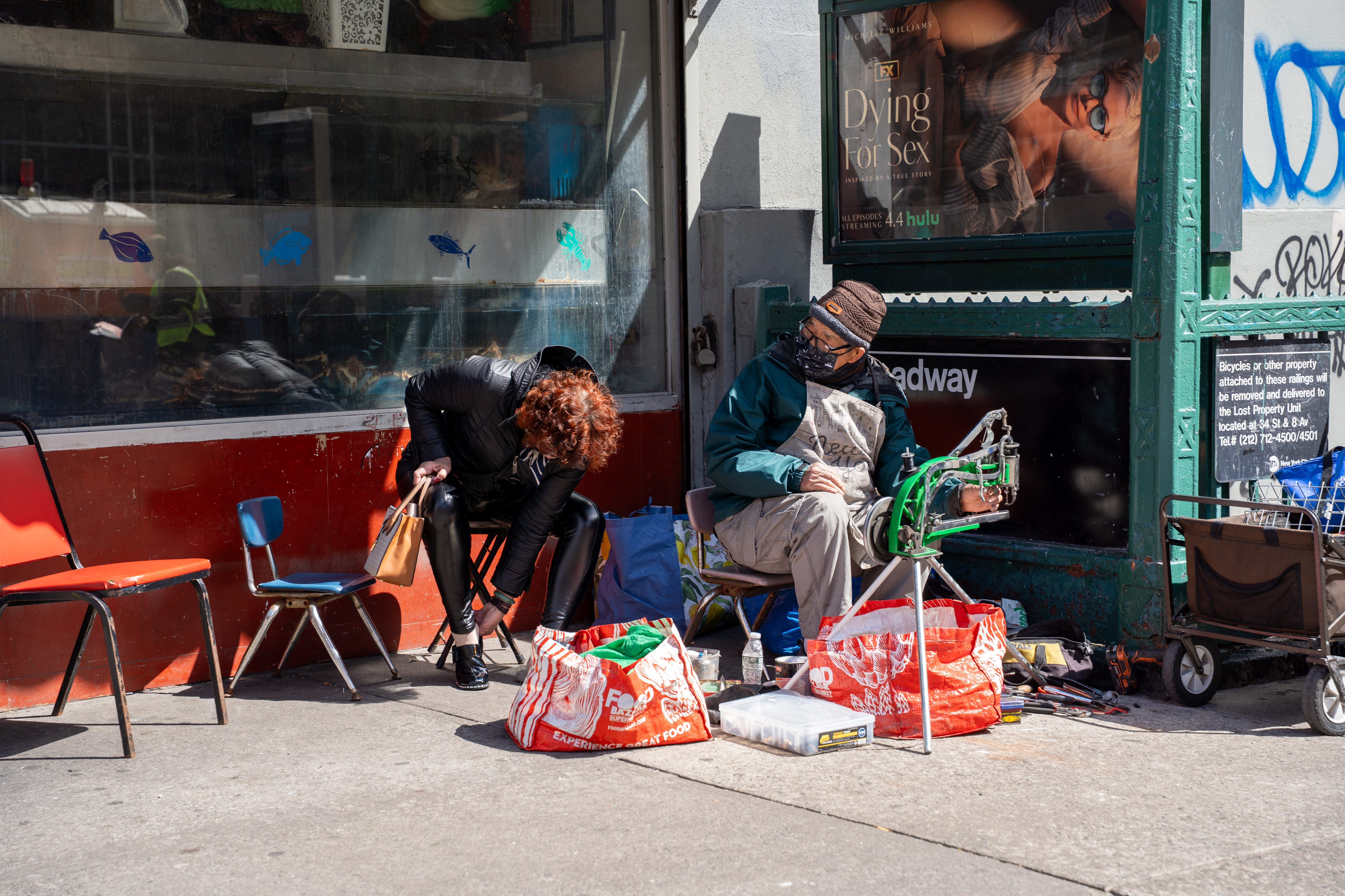
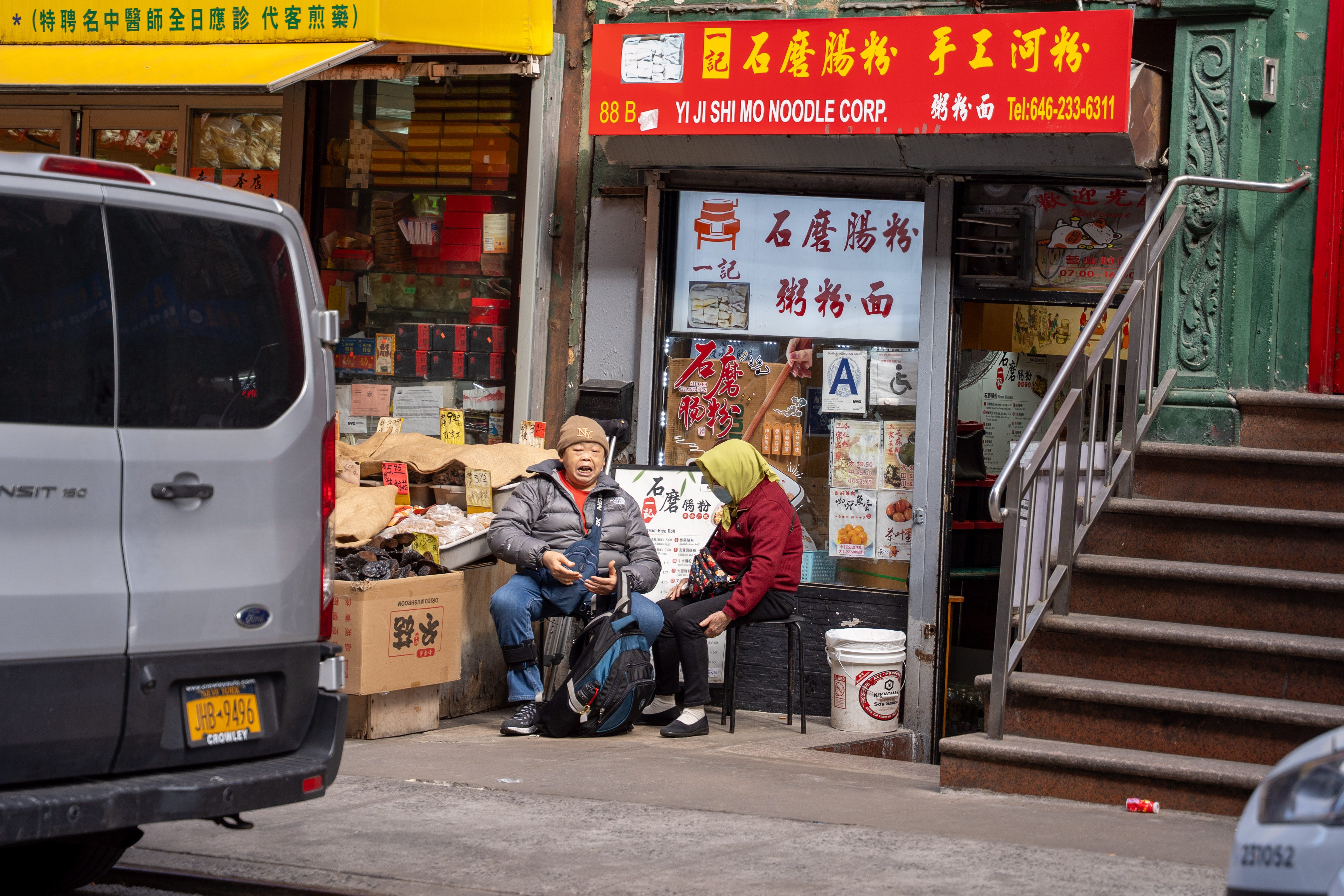
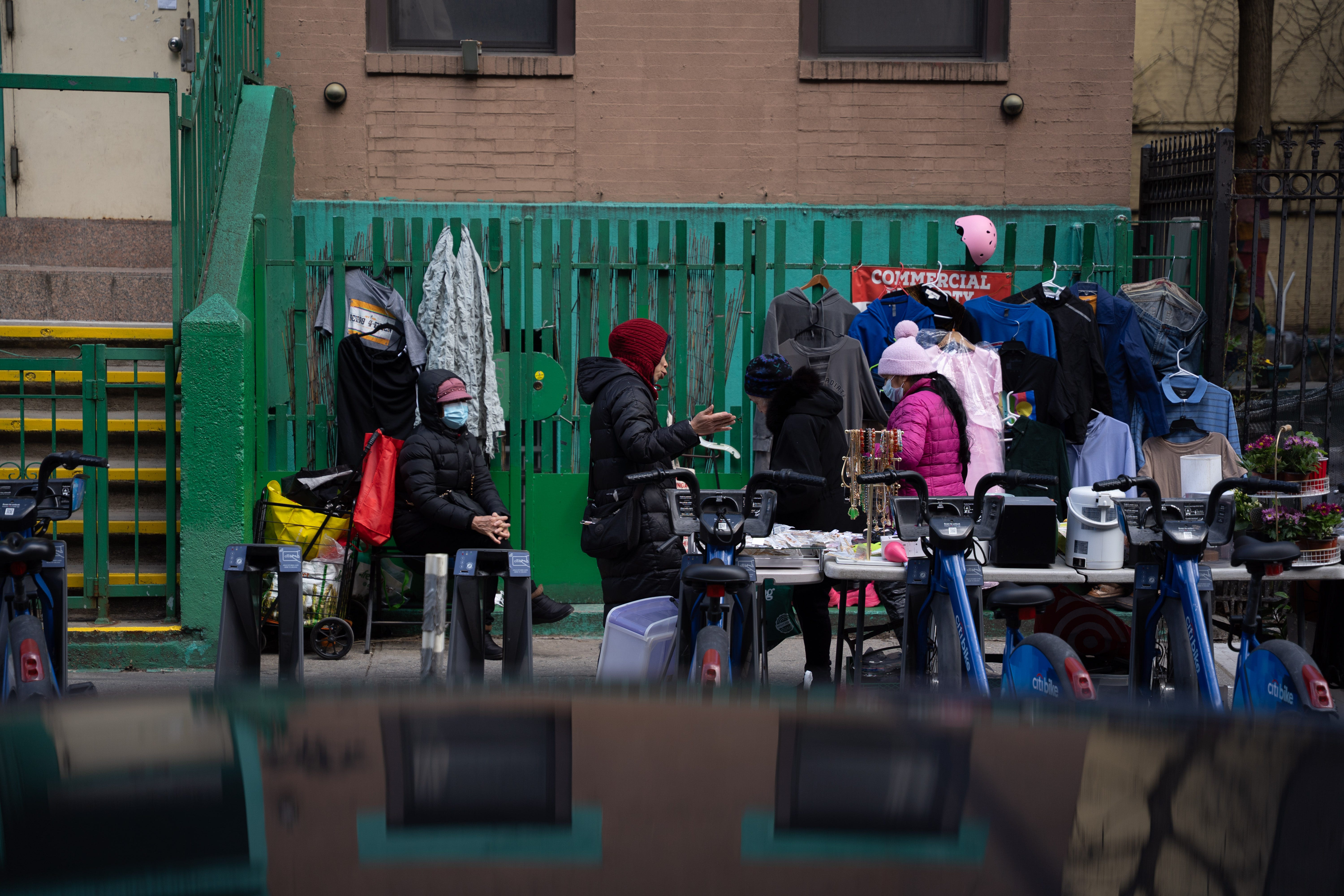
Beyond the storefronts, I tried to notice the in-between moments—an unlicensed cobbler, a loud sidewalk conversation, some bargain hunting by the Citibike stands. These smaller scenes give Diaspora more texture.
I doubt they’ll make the final 15–20 image set I submit to galleries or competitions, but they’re an essential part of the Chinatown story.
Thoughts on Where Chinatown Begins and Ends
Google Maps gets the rough area right. The Study Area feels a little too generous. But for me, Chinatown extended wherever the visual cues persisted—red lanterns strung across the street, hand-painted Chinese characters on signs, someone wheeling a grocery cart or carrying Styrofoam takeout boxes.
The borders felt less like lines and more like gradients. They shift depending on the hour, the direction you're walking, the smell in the air. I’m hopeful that investment in the area can help hold onto what's here—before the neighborhood’s edges dissolve any further.
An afterthought — new views opening up in Manhattan.
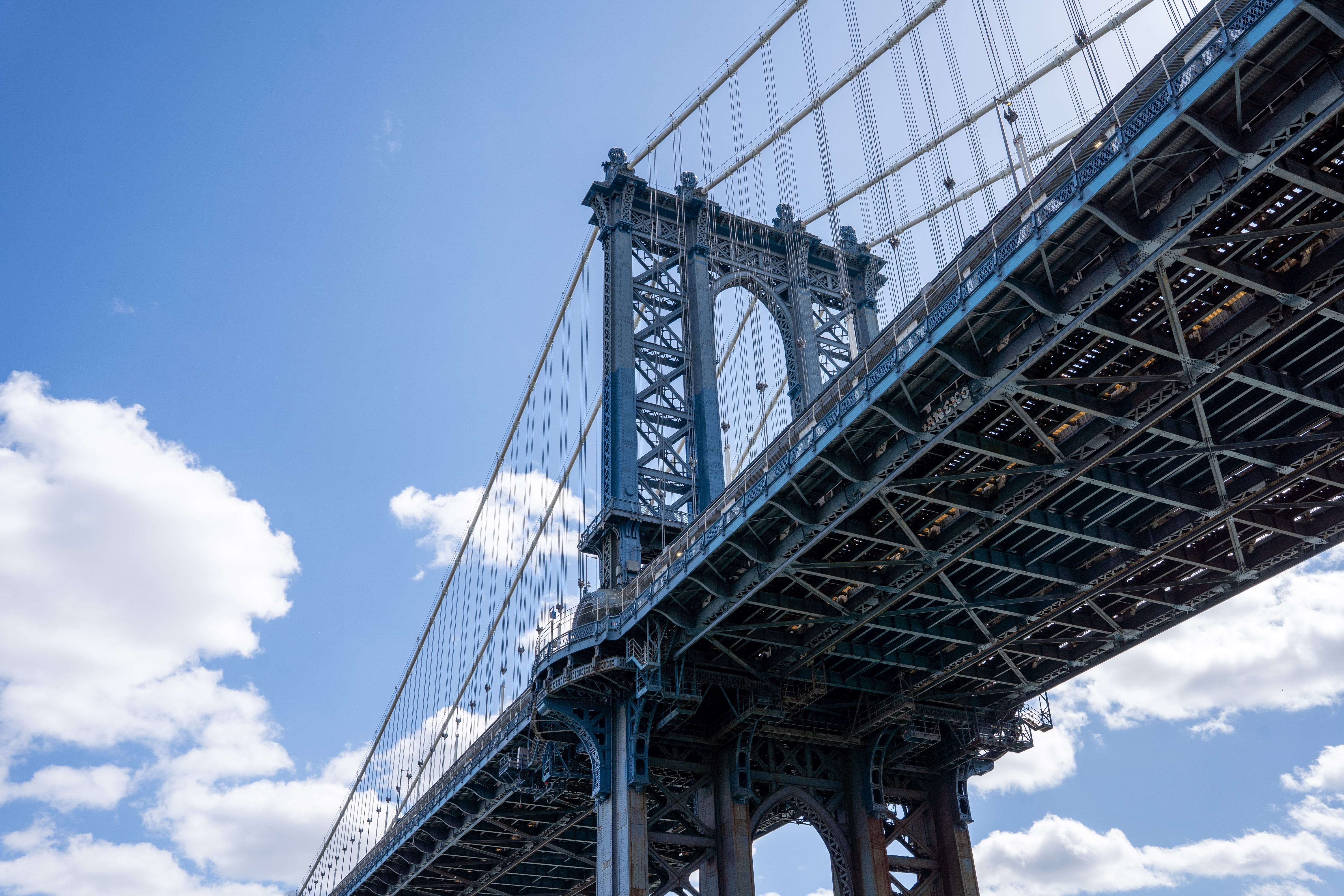
At the beginning of my walk, I wandered into a newly redeveloped stretch along the East River. It’s still under construction, but you can feel something taking shape.
Google Maps calls it the East River Greenway but it looks like it’ll be years before it’s completed. We’ll see if the name sticks.
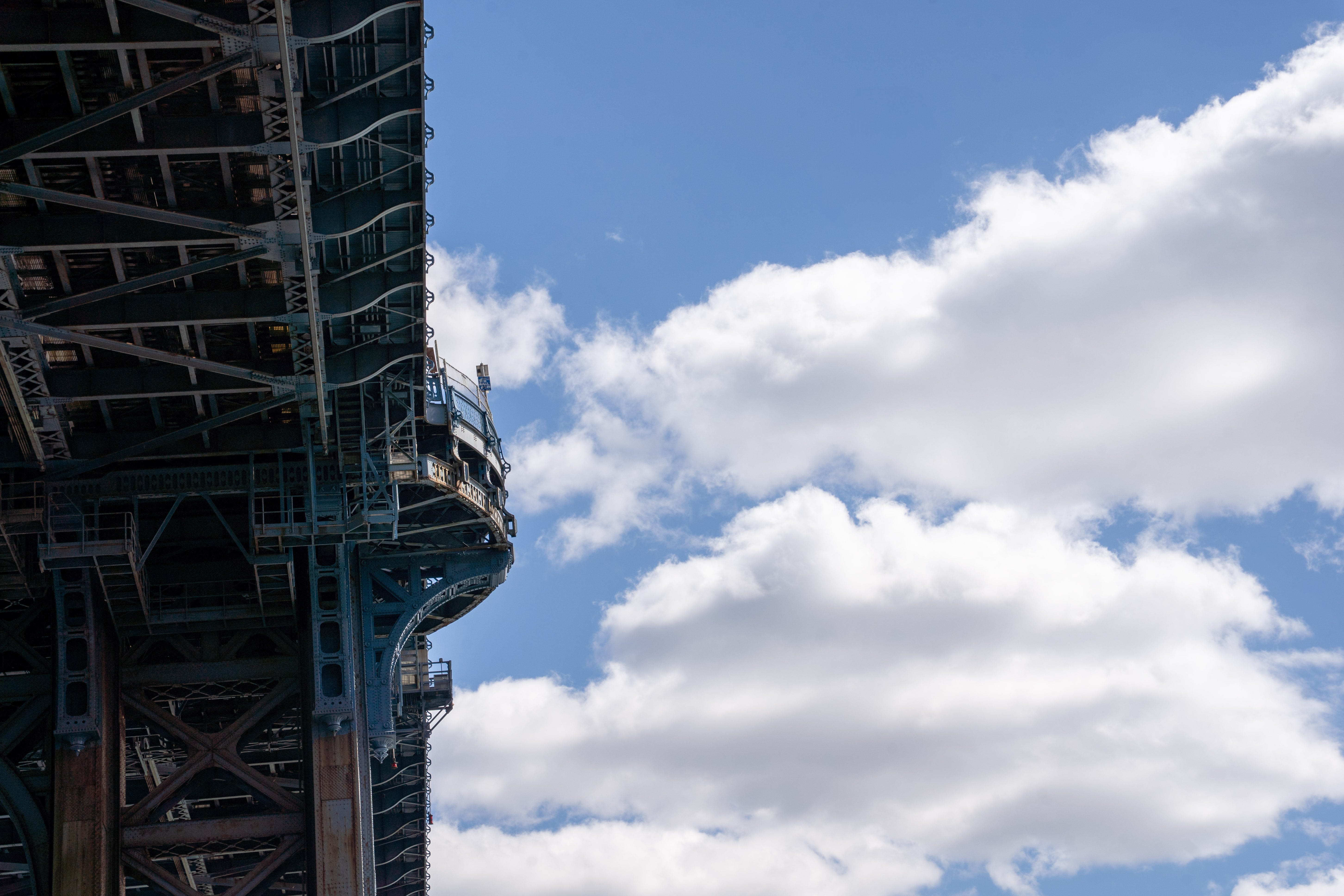
Despite the half finished park you could see the intent behind the development. The view from there was stunning. All three bridges—Brooklyn, Manhattan, Williamsburg—lined up in soft late-afternoon light. I paused to take a panorama and made a mental note to do one in Chinatown proper. Might make a good Substack header.
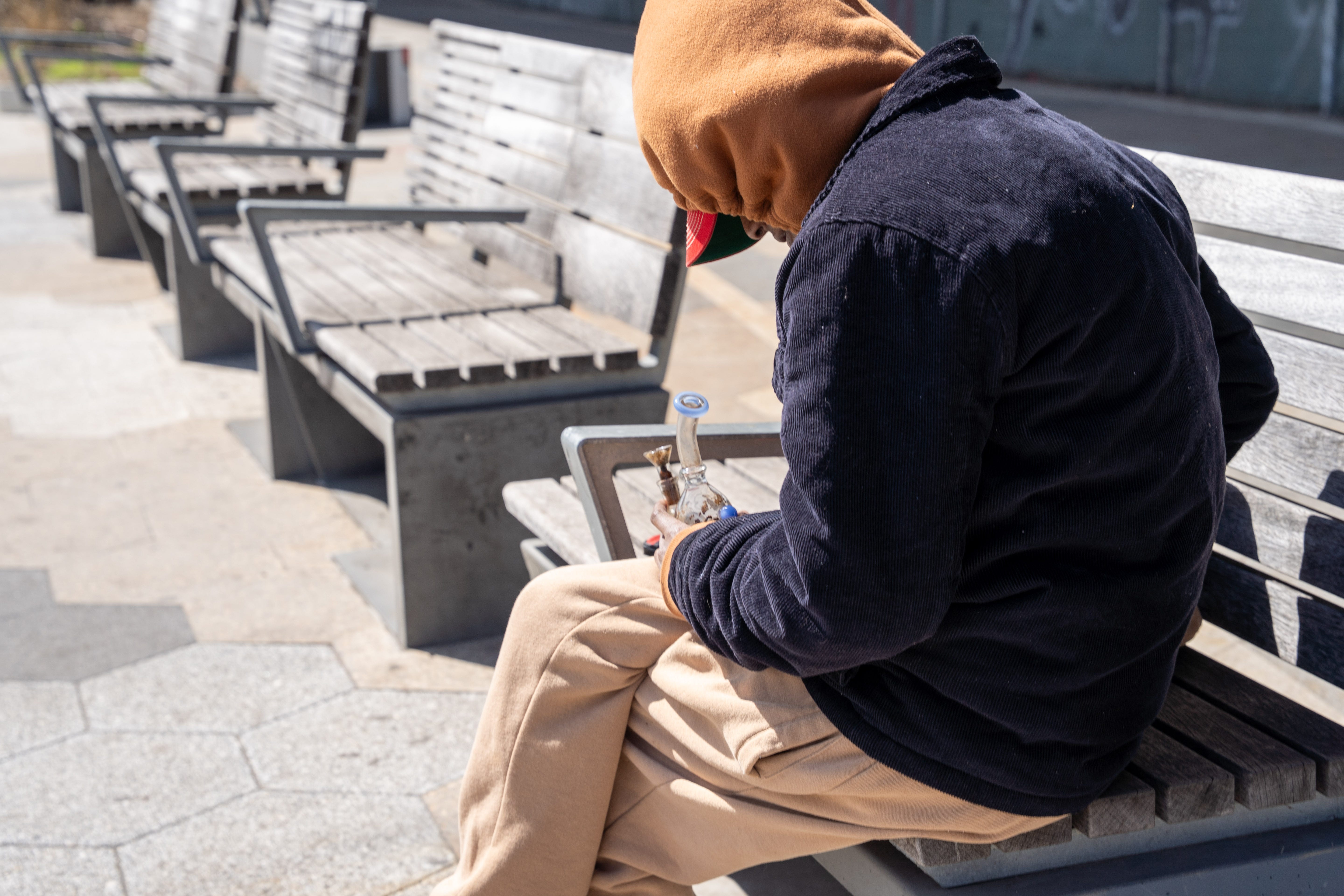
The path also cuts through some rougher patches. Under the bridges, the geometry is striking, but there’s a lot of visible drug use. It felt totally fine during the day—construction crews everywhere, lots of foot traffic—but I wouldn’t linger there after dark.
Maybe in a few years I’ll do a timelapse sunset shoot, but for now, I’ll stick to my walks in broad daylight.